Natural conditions and resources. Natural conditions of the West Siberian Plain
How is the region's economy developing?
Geography
Before learning about natural resources Western Siberia, let's talk about her geographical boundaries. The region is located on the territory between the Yenisei River in the east and the Ural Mountains in the west. In the north, the border is defined by the bays of the Kara Sea, and in the south by the Altai Mountains and Kazakhstan.
With an area of 2.5 million square kilometers, Western Siberia makes up almost 15% of the total territory of the state. Kemerovo, Omsk, Novosibirsk, Tomsk, Tyumen regions, the Altai Republic and the Altai Territory are all Western Siberia. The region's natural resources are an important part of the country's economy.
Most of the territory is located on the West Siberian Plain, within which there are two large depressions separated by Siberian ridges. In the southeastern part, the foothill areas begin, going to the foot of the Altai Mountains.
Climatic conditions
The natural conditions and resources of Western Siberia are interconnected. The character of some influences the formation of others. The region is located inland, so a continental climate has formed here. The proximity of the Arctic Ocean made it tougher and harsher. The mountain ranges of the southeast prevent the penetration of warm and humid air masses from the Asian side.
Western Siberia is characterized by cold winter period With maximum temperature up to -60 degrees. The soil here freezes quickly, contributing to the spread of permafrost. Summer is hot, especially in the south, temperatures can reach 30-35 degrees.

According to the characteristics, steppe, forest-steppe, forest, forest-tundra and tundra zones were formed. The climatic natural resources of Western Siberia are quite suitable for Agriculture. In the steppe regions there are enough warm days and precipitation, most of which falls in the summer, for growing grain and industrial crops.
Water resources
Hydrological natural resources of Western Siberia are represented by diversity groundwater. The region is located in the area of an artesian basin; in different areas, water salinity can vary significantly.
The main wealth is the rivers; there are about two thousand of them. The river network is sparse and varies depending on the terrain and climate. The largest are the Ob, Yenisei, and Irtysh. They are characterized by snow feeding in spring, rain feeding in autumn and summer. Due to the flat terrain and slight slopes, river speeds are usually low.

Of course, rivers are not all that Western Siberia has. Natural resources also include lakes, of which there are more than a million in the region, and swamps. By origin, thermokarst and moraine-glacial lakes are distinguished. The Urals part of the region is characterized by the presence of fog lakes. Their main feature is a sharp decrease in water level in summer, up to complete disappearance.
Forest resources
Natural zones from north to south smoothly flow into one another. In accordance with this, the natural resources of Western Siberia are also changing. In the southern regions due to large quantity sand is dominated by pine trees. Relict black taiga is common in Altai.
The forest-steppe is characterized by meadow, grass and cereal vegetation, birch and aspen. The forest zone stretches for 1000 kilometers. It combines taiga and swamp vegetation. Dark coniferous trees grow here, such as pine, fir, as well as birch and aspen.

The forest-tundra zone is the border between the taiga and the tundra itself. It alternately contains swampy areas, woodlands and shrubs. Forest areas located mainly in river valleys. They are mainly represented by larches. The tundra is characterized by the presence of mosses and lichens, shrubs, and low grasses. Here you can find blueberries, princelings, cloudberries, dwarf species of willow and birch.
Soils
In the steppe and foothill regions of Western Siberia, fertile chernozems are also common, allowing this area to be used for growing different cultures. In the south there are malts and solonetzes.
Above the steppe regions there are areas with podzolic and soddy-podzolic soils. The forest zone is characterized by poorly drained soils, which leads to the formation of swamps and new forests. Semi-hydromorphic ones are formed in wetlands, and in river floodplains -

Tundra-gley and peaty areas are characteristic of northern regions Western Siberia. Soil fertility is greatly affected by permafrost. Unlike other, mostly forested areas, gleying is not very pronounced.
Minerals
The basis of the region's resource base is minerals. Oil and gas production is what Western Siberia is famous for. Natural resources and the economy based on them are an important part general economy countries. There are six oil and gas regions in Western Siberia. The largest oil fields are Priobskoye, Mamontovskoye, Samotlorskoye. Gas fields are located in the Yamalo-Nenets region.

The region's largest coal deposit is located in the southern part. In the Altai Territory, Kemerovo Region and Gornaya Shoria there are deposits of magnetite ores. Nepheline and alumina are mined in Western Siberia.
The Altai region is rich in reserves of polymetallic, tungsten, molybdenum, iron, zirconium ores, gold, mercury, marble; steppe lakes contain salts and soda. In the Kemerovo region there are deposits of dolomite, limestone, and refractory clay. The Omsk region has reserves of titanium ores.
Natural resources of Western Siberia (table)
The natural resources of the region have long served as the basis for the development of various sectors of the economy (see table).
Terms and resources | Peculiarities | Application |
|
Climatic | Sharply continental, harsh in the north, milder in the south | Tundra, forest-tundra, steppe, forest-steppe, forest natural zones | Livestock farming, growing wheat, industrial crops in the south |
Rivers, lakes, groundwater | The density of the river network and the depth of water vary from north to south | Fishing, cargo transportation, hydropower |
|
Meadows, pine forests, coniferous and small-leaved forests | More than 80 million hectares of forest, 10% of the country's forest fund | Pastures, wood processing industry |
|
Soil | Tundra-gley, podzolic, sod-podzolic, chernozems and chestnut soils | The central regions are favorable for the emergence of forests, and the southern regions are favorable for agriculture. | Pastures, growing various crops |
Mineral | Gas, oil, coal, manganese, tungsten, molybdenum, iron, magnetite ores, salt, soda, limestone, gold, mercury | Fuel and energy resources | Energy, ferrous and non-ferrous metallurgy |
Natural resources and environmental safety of Western Siberia
The region's provision with various resources is quite high. The extension from north to south contributed to the formation of several natural areas, which differ from each other in plant and soil cover, river regimes and density of the river network, and climatic conditions.

Western Siberia has enormous industrial and agricultural potential. The fertile southern soils are excellent for growing crops. Meadows rich in grasses serve as pastures, thanks to which livestock farming develops. In industry, the most developed areas are oil, coal and gas mining, as well as wood processing. More than 70% of all Russian oil is produced in the region.
The development of the oil and gas and wood processing sectors contributes to economic growth, but at the same time is a major factor in environmental pollution. The consequence of active industrial activity is water pollution, which, in turn, leads to a lack of water resources.
The use of pesticides also has a negative impact. This is directly reflected in the air and soil. The land is gradually becoming less suitable for agriculture. In addition, it is important to remember that excessive and incorrect extraction of natural resources can permanently reduce their reserves.
Western Siberia is rich in minerals - oil, gas, coal, ores. The area of promising oil and gas-bearing territories is estimated at more than 1.7 million km2; the main fields are confined to the Middle Ob region (Samotlorskoye, Megionskoye and others in the Nizhnevartovsk region; Ust-Balykskoye, Fedorovskoye and others in the Surgut region). Place of Birth natural gas in the polar region - Medvezhye, Urengoy and others, in the Arctic - Yamburgskoye, Ivankovskoye and others. New deposits have been discovered on the Yamal Peninsula. There are oil and gas resources in the Urals.
Gas and coal resources. Gas fields have been discovered in the Vasyugansk region. In general, more than 300 oil and gas fields were discovered in Western Siberia. The main coal resources are located in Kuzbass, whose reserves are estimated at 600 billion tons. About 30% of Kuznetsk coals are coking. Coal seams are different high power and lie close to the surface, which makes it possible, along with the mine method, to conduct open pit mining. In the northeast of the Kemerovo region there is the western wing of the Kansk-Achinsk brown coal basin. The Itatskoe deposit is especially notable here. The thickness of the layers reaches 55-80 meters; They lie at depths from 10 to 220 meters. The basin produces the cheapest coal in Russia. On South Novosibirsk region the Gorlovka basin, rich in anthracite coals, is located; in the north Tyumen region- Chulym-Yenisei brown coal basins, which are not yet exploited. Within Western Siberia there are large peat deposits, more than 50% of the total Russian reserves.
Ore. The West Siberian iron ore basin is distinguished by significant deposits:
a) Narymskoe;
b) Kolpashevskoe;
c) Yuzhno-Kolpashevo.
They are dominated by brown iron ores. Richer iron ore deposits of magnesium ores are available in Gornaya Shoria - Tashtagol, Sheregesh and in Altai - Inskoye, Beloretskoye. In the south of the Kemerovo region there is the Usinsk manganese ore deposit, in the east - the Kiya-Shaltyrskoye nepheline deposit, in the Altai Territory - the Aktash and Chaganuzin mercury deposits.
Mineral resources. In Western Siberia there are reserves of soda and other salts in the lakes of the Kulunda steppe. The Novosibirsk and Kemerovo regions are rich in limestone. Western Siberia has thermal iodine-bromine springs. Altai is rich in building materials.
Forest resources. For the industrial development of Western Siberia important have its forest resources. The forested area exceeds 72 million hectares, and the total timber reserve is about 10 billion m3 (11% of Russia's reserves). Of the total wood reserves, the share of ripe and overripe forests accounts for 5.8 billion m3 (about 12% of these reserves in Russia). West Siberian forests are characterized by high development of small hardwood and decreases compared to other heavily forested areas of the country specific gravity coniferous species.
The overwhelming majority of the region's forest resources are concentrated in the West Siberian taiga zone, and the rest is approximately equally distributed between the Altai Territory and the Kemerovo Region, where mountain forests predominate. A small share of forest resources (about 5%) falls on the forest-steppe territories of Western Siberia. Stocks of mature and overmature plantings, as well as natural increase make it possible to cut about 100 million m3 of wood per year in the region, or 3 times more than at present.
For economic assessment forest resources of Western Siberia, its proximity to forest-deficient areas of the country compared to Eastern Siberia and the Far East is important. At the same time, the high swampiness of the Western Siberian taiga and the mountainous nature of the forests of the Kemerovo region and Altai Territory make it difficult road construction and the involvement of forests in exploitation based on land transport of forests. Focus on water transport leads to the fact that the forest is mostly cut down coniferous wood, and a significant part of hardwood remains standing due to the complexity of organizing the alloy.
All this allows us to assess the conditions for the development of logging industrial products in Western Siberia as less favorable than in the southern and central regions of the Krasnoyarsk Territory and the Irkutsk Region. But as forests deplete in other areas of the country, the feasibility of wider use of Western Siberian forests will increase. In this case, first of all, forest areas will be used that lie in the zone of gravity towards new railways, being built in Western Siberia, to oil and gas fields.
Water resources. In terms of water resources, Western Siberia is second only to Eastern Siberia and the Far East. There are more than 2.1 thousand rivers in the region, the total length of which exceeds 250 thousand km, and total area water surface - 5 million hectares. The region accounts for about 15% of the annual flow of Russian rivers. In addition, in Western Siberia there are more than 1 million lakes with a total area of 10 million hectares.
The assessment of water resources consists of the conditions of navigation, hydropower resources, the uniformity of their distribution throughout the region (the latter affects the organization of industrial and drinking water supply, and, consequently, the location of industry and agriculture) and fisheries.
The Ob, Irtysh and their 61 tributaries are used for navigation. The total length of navigable sections of the rivers is 42 thousand km. The duration of navigation on the Ob and Irtysh ranges from 140 days in the lower reaches of the Ob to 190-200 days in the south of the region. Such a significant difference in the duration of navigation makes it difficult to organize mass river transportation along the Irtysh and especially along the Ob. This situation is further aggravated by their meridional orientation, while the main economic ties in Western Siberia have a latitudinal direction. As a result, the volume of transportation in the Ob-Irtysh basin is up to recent years was small, and their cost was relatively high.
The river network of Western Siberia is characterized by its deep branching - in taiga regions there are 350-400 km of rivers per 1000 km2 of territory. Most of these rivers are summer period They become shallow and become unsuitable even for small vessels, but in the spring, during high water, shallow-draft vessels can enter them and deliver the necessary cargo to the inland areas.
Despite the significant water content of West Siberian rivers, their hydropower significance is small. The total potential resources of large and medium-sized rivers in the region amount to 250 billion kW/h (7.5% of the all-Russian total). The share of Western Siberia in the all-Russian reserves of effective hydro resources is even smaller. Essentially, the hydro resources of the mountain rivers of the Biya, Tom and especially Katun region are of practical interest, where it is possible to build a hydroelectric power station with a capacity of up to 1 million kW at small area flooding.
The flat nature of the relief of the vast majority of Western Siberia not only reduces the possible unit capacity of hydroelectric power stations, but also leads to the creation of huge reservoirs. Reservoirs flood valuable agricultural land, increase waterlogging in the surrounding areas, reduce the area of floodplain meadows, depriving livestock of cheap natural feed, and have a negative impact on the microclimate.
The river network of Western Siberia is developed very unevenly. Almost 1/5 of its territory - the Kulundinskaya and Barabinskaya drainage basins - is generally devoid of large rivers. Existing watercourses that flow into closed lakes dry up during dry periods. In mountainous areas, where the terrain conditions make it impossible to locate large enterprises and cities, there is essentially no significant need for water.
In a number of steppe and forest-steppe regions of Western Siberia, a serious problem is the organization of water supply for agriculture, since groundwater in many cases is mineralized and unsuitable for household and drinking use, so it is necessary to build deep wells to use groundwater, which these areas are rich in.
Serious problems arise when organizing water supply to the coal centers of the Kemerovo region, since most of them lie on small tributaries of the Tom, originating from the low Salair ridge, at the same time due to the presence of large rivers - the Ob, Irtysh and Tom, flowing at relatively short distances from the water-scarce areas, water supply to these areas can be organized at relatively low costs.
The rivers and lakes of Western Siberia are of great value for fisheries, since they concentrate significant resources of valuable fish species - whitefish, sturgeon and salmon. Large resources of small fish are available in numerous lakes, including slightly brackish ones.
Western Siberia stands out among the economic regions of the country for its vast agricultural lands, which are estimated at 36 million hectares. Of these, more than 50% are arable land, almost 20% are pastures. A feature of the regions' hayfields is a large proportion of flooded meadows with increased productivity, however, a significant part of the meadows is concentrated in the Ob and Irtysh floodplains and for a long time is under water. This makes them difficult to use existing methods and requires the development of special techniques.
Western Siberia is the greatest plain of Eurasia with vast areas of swamps, oil and gas reserves of world importance; Russia's main fuel base. The region occupies the territories of the West Siberian Lowland and the mountainous regions of Altai, Kuznetsk Alatau and Salair Ridge.
How is the nature of Western Siberia different? In the formation of the modern relief of the West Siberian Lowland, repeated advances of the sea and glaciers, which deposited a thick layer of sedimentary rocks, played a major role. Therefore, the relief is leveled. Across Western Siberia from the Ob to the Yenisei in a latitudinal direction, the system of moraine hills Siberian Uvals stretches for 900 km with maximum height 286 m.

Rivers flow very slowly along this slightly inclined surface of the huge Western Siberian “bowl”. There are over 2 thousand of them. Distinctive feature Siberian rivers are characterized by their shallow, but extremely wide valleys with numerous channels and lakes - oxbow lakes. In spring, rivers overflow for many kilometers around. Western Siberia accounts for a quarter of the flow of Russian rivers. Large rivers have great importance for shipping. In the arid southern part of Western Siberia, on the border with Kazakhstan, river water is used for irrigation.

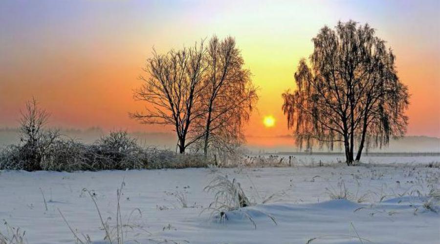
The climate of Western Siberia is characterized by continental features, which intensify in the south of the plain. In winter, windless, sunny, frosty weather prevails. In summer, when arctic air masses collide with heated southern air, cyclones occur, accompanied by precipitation. The hot Western Siberian summer is very difficult to endure due to high humidity and countless hordes of midges: mosquitoes, midges and horse flies.

D. Utenkov. Discovery of Siberia. The kingdom of swamps and taiga of Western Siberia is innumerable, incalculable clouds of all kinds blood-sucking insects. And here, perhaps, with full right to call the owner of the taiga not a bear, wolverine or sable, but an ordinary mosquito. Special accounting has established that in places where there are a lot of midges, over a thousand mosquitoes, more than 2 thousand midges, attack a person within 3 minutes!


Forest-tundra is a larch and birch forest, to which pine and cedar are added at the southern border. Forest areas in forest-tundras are confined to river valleys, which are the most drained and warm, since river water brings heat here from the south. The main reindeer pastures are concentrated in the tundra and forest-tundra.

Due to the widespread occurrence of swamps in the forest zone of Western Siberia, it is called the forest-swamp zone. Flat undrained areas are occupied by swamps, and taiga forests themselves occupy mainly the slopes of river valleys, sloping and elevated areas of interfluves. The forests of Western Siberia constitute its most important natural resource However, local wood grown in wetlands is generally of poor quality.


High swampiness complicates the development of the richest resources of this region and complicates the construction of roads and settlements. In many areas, travel by land is only possible in winter, when the swamps freeze. At the same time, Western Siberian swamps have countless reserves of peat, which can be used as chemical raw materials, fuel, organic fertilizer, bedding material in livestock farming.


How can we explain that Western Siberia is concentrated largest deposits oil and gas? The West Siberian Lowland formed on the West Siberian Plate with a deeply depressed folded Paleozoic foundation. It contains a thick, almost six-kilometer-long layer of “layer cake”, consisting of sedimentary rocks represented by clays, sandstones and sands of marine and continental origin.

The country's largest oil and natural gas deposits (West Siberian oil and gas region) are associated with the sedimentary cover of the West Siberian Plain. More than 500 deposits of these important combustible minerals have been identified here, containing more than 60% of Russian oil reserves and about 90% of natural gas. The most important oil fields are concentrated in the Khanty-Mansiysk (Samotlorskoye, Megionskoye, Salymskoye, Mamontovskoye, Ust-Balykskoye and others), and natural gas fields in the Yamalo-Nenets Autonomous Okrug (the world's largest Urengoyskoye and Yamburgskoye fields, as well as Medvezhye near the city of Nadym, Zapolyarnoe, etc.)
 Intensive oil production and an ever-expanding network of pipelines have already caused irreparable damage to the natural complexes of Western Siberia: oil “spills” during production and transportation (in winter, pipes laid directly on the surface of the earth burst) have resulted in ruined reindeer pastures and forest lands, dead fish in the tundra and taiga rivers and lakes.
Intensive industrial development natural resources Western Siberia caused serious damage not only to nature, but also to indigenous peoples (Nenets, Khanty, Mansi and others), depriving them of a significant part of their hunting and fishing grounds. To protect traditional types economic activities and culture of these peoples, in the Khanty-Mansiysk Autonomous Okrug, for example, special territories of priority nature management were allocated - ancestral lands.


 Back forward
Attention! Slide previews are for informational purposes only and may not represent all the features of the presentation. If you are interested this work, please download the full version.
Target: study the natural conditions of the West Siberian Plain and their impact on the life and way of life of the population.
Tasks:
- Educational:
- expand knowledge about the West Siberian Plain - as a large natural complex;
- to form knowledge about the uniqueness of the natural conditions of the West Siberian Plain.
- Educational:
- continue formation
- skills to work with various sources information;
- critical thinking, skills to develop, formulate and defend one’s point of view, to support it scientific knowledge;
- value-worldview, sociocultural and information competences;
- develop independent thinking.
- Educational:
- to cultivate geographical culture and aesthetic perception of geographical objects, a sense of love for native nature;
- promote spiritual development and harmonization of the child’s personality;
- to form the environmental consciousness of schoolchildren;
- nurturing skills in creative knowledge acquisition (application of individual logical techniques and ways creative activity);
- developing skills for creative application of knowledge (application of acquired knowledge in a new situation).
Methods according to the nature of cognitive activity: explanatory-illustrative, partially search.
Forms of organization of cognitive activity: individual and frontal work.
Methods organization of cognitive activity: conversation, discussion - verbal (audio), analysis of various sources of information.
Equipment: physical map of Russia, computer, projector, presentation prepared using the Mouse Mischief program, video film Galileo.vipysk.729. (2011.04.14.) about the Khanty.
Lesson type: learning new material.
DURING THE CLASSES
I. Organizational moment
II. Setting learning objectives
Identify the features of the natural conditions of the West Siberian Plain.
Consider the features of life and everyday life of the indigenous population - the Khanty.
III. Updating students' knowledge. Motivation for learning activities
– Today we will talk about the natural features of the West Siberian Plain. Show the West Siberian Plain on the map? (The student shows the West Siberian Plain on the map).
The plain has an extremely flat topography with heights of no more than 100 m above sea level. Only in the south and east does the height above sea level reach 250 meters. The climate of the region ranges from arctic in the north to temperate continental in the south.
IN: What are the reasons for the continental climate of Western Siberia?
ABOUT: The position, predominantly in temperate latitudes, determined the amount of solar radiation received by the area. The distance from the Atlantic and Pacific oceans determined the continental climate. The flatness of the territory allows cold masses of Arctic air to freely penetrate far to the south from the Kara Sea, and warm air masses from Kazakhstan and Central Asia to penetrate far to the north. Mountains along the periphery fenced off the West Siberian Plain from Atlantic air masses from the west and Central Asian air masses from the southeast.
Due to the flatness of the region and its large extent from north to south, natural zoning is clearly expressed on the territory of Western Siberia. In the north, along the coast of the Arctic Ocean, there is a zone of arctic deserts, it gives way to a zone of tundra and forest-tundra, and then the widest zone in the region - the taiga. Taiga dark coniferous forests of spruce, cedar, fir, larch with islands of pine-larch forests pass to the south into a narrow strip of deciduous forests, forest-steppe and steppe. Soils vary from arctic to steppe black soils. Forest-steppe and steppe with fertile gray and brown forests, chestnut and chernozem soils heavily plowed. The West Siberian Plain is densely covered with rivers, the largest of which originate in the mountains of Southern Siberia. The main river of the region is the Ob, which flows into the Kara Sea. It is navigable throughout. About 30% of the area is occupied by swamps.
The West Siberian Plain is the richest territory in Russia in natural resources. Here, for a long time, local residents hunted fur-bearing animals and game. Taiga has valuable wood, there are a lot of fish in the rivers. Tundra is a pasture for deer. But the main wealth of Western Siberia is its mineral resources.
The main resources are oil and gas, peat, coal, iron ores. The West Siberian Plain is a unique oil and gas province of the Earth. Industrial oil and gas deposits are distributed here throughout almost the entire 2000-meter section of Mesozoic sediments. The average depth of oil and gas bearing strata in it ranges from 1500m to 2500-3000m.
Western Siberia is the country's main oil production base; it accounts for over 70% of all-Russian oil and natural gas production. Searches in the depths of Western Siberia for “black gold” and “blue fuel” made it possible to discover large reserves iron ores
in the north of the Novosibirsk region.
The minerals of Mesozoic deposits also include hot waters with a temperature of 40 to 120 o C and containing dissolved salts of chlorides and carbonates, as well as iodine and bromine. They form a huge artesian basin at a depth of 1000 to 3000 m in the Tyumen, Tomsk, Omsk and Novosibirsk regions.
Thus, the West Siberian Plain is a province rich in water, territorial resources, and vast reserves of oil, gas, and iron ores.
IN: However, despite the fact that Western Siberia is rich in natural resources, their development is difficult.
ABOUT: What is this connected with?
IN: The main problem of gas and oil development in Western Siberia is difficult natural conditions. Living and working conditions of people are complicated by severe frosts and hurricane winds in the north. The soil in the north is bound by permafrost, which complicates construction. In the summer, a huge number of blood-sucking insects - midges - do not allow people to work in peace, they pester animals. But the main problem of the development of Siberia is the huge areas of marshy swamps.
- What do you think is the reason for the high swampiness of the area?
- Poorly dissected terrain with low relative heights leads to obstructed drainage surfaces. Rivers have a slow flow and strong meandering (meanders are radiated in river beds, lengthening the path of the river). In spring, the water level in rivers flowing from south to north rises significantly. It's warm in the upper reaches, big water
- Peat contains up to 90% water and contributes to even greater accumulation of water in the swamp, and this leads to rising groundwater in areas adjacent to peat bogs and their swamping.
- Little evaporation due to low amount of solar radiation.
Before the development of the resources of Western Siberia, the peoples of the North lived here for centuries - the Selkups, Nenets, Khanty. They hunted, fished and lived in harmony with nature. The indigenous population of Western Siberia was engaged in hunting and fishing. The inhabitants of the north - the Nenets - roamed with reindeer. Nomadic reindeer herding made it possible to preserve pastures, which were restored only after 10-15 years. Tundra plants grow slowly, summers are too short and cold. The Khanty and Selkups were careful about the nature around them, which provided them with food, clothing, and shelter. Hunters and fishermen lived in low huts, with the roof top insulated with earth. Ice floes served as glass in winter. With the help of a bow, the Selkups hunted squirrels, geese, and ducks. Served as food salty fish and dried yukola. From dried fish ground flour - flour. Waste (fish entrails, head bones) was not thrown away, but the fat was melted from it. Their gall bladders were drowned with bile and used to process suede. Glue was made from sturgeon bladders. The glue was used to make a valuable hunting tool - the bow - and in the manufacture of skis. Fish skins were used to make bags in which food was stored. That is, the economy of the indigenous population was waste-free, and there used to be more fish in the rivers than now. Oil workers came and destroyed the pastures with the caterpillars of all-terrain vehicles, there were fewer fish in the rivers, and the oil poisoned the fish. Now 2/3 of the population of the entire Eastern macroregion lives in the region, average density– 6 people per 1 km 2.
Residents are distributed very unevenly. The southern regions along the Trans-Siberian Railway are the most densely populated. The taiga is inhabited mainly by river valleys; the population density of the tundra is only 0.6 people. per 1 km 2. More than 90% of the population is Russian, representatives of indigenous nationalities also live, but their share is small, for example, the Khanty and Mansi make up only about 1.5% in their national-territorial entities. Urbanization coefficient – 71%. The large cities of Western Siberia are located mainly at the intersection of railways and shipping routes. The largest of them are millionaire cities - Novosibirsk and Omsk.
IV. Learning new material
– Now let’s watch a short story about the indigenous inhabitants of Siberia – the Khanty. When viewing, pay attention to the following aspects:
1. What are the features of the life and way of life of the indigenous small peoples of Siberia?
2. What is the main food of small nations?
3. What impact does industrial development have on the livelihoods of small nations?
Watching the video Galileo.vipysk.729.(2011.04.14.) about the Khanty .
V. Consolidation
Student answers to questions:
1. The need for self-sufficiency. Food is obtained by hunting and fishing; clothes and household items are created independently.
2. The main food of small peoples is fish and venison.
3. Extraction mineral resources reduces the habitat of small nations, but makes it possible to enjoy some of the benefits of civilization, for example, snowmobiles.
Questions:
IN: What natural resources is the West Siberian Plain rich in?
ABOUT: The West Siberian Plain is rich in water, territorial resources, oil, gas, peat, and iron ores.
IN: Is it possible to fully exploit the potential of Western Siberia and what is the reason for this?
ABOUT: It is impossible to use the entire resource potential of Western Siberia, since this is hampered by the high swampiness of the region, permafrost in the northern part, harsh climate in winter, and the presence of blood-sucking insects in summer.
VI. Homework
NATURAL CONDITIONS OF WESTERN SIBERIA
Western Siberia is the greatest plain of Eurasia with huge areas of swamps, oil and gas reserves of world importance; Russia's main fuel base.

- In the formation of the modern relief of the West Siberian Lowland, repeated advances of the sea and glaciers, which deposited a thick layer of sedimentary rocks, played a major role. Therefore, the relief is leveled. A system of moraine hills, the Siberian Uvaly, with a maximum height of 286 m, stretches across Western Siberia from the Ob to the Yenisei in a latitudinal direction of 900 km.


- The enormous extent in the meridional direction led to a clear manifestation latitudinal zonality in the nature of Western Siberia.
- There are only zones of broad-leaved and mixed broad-leaved-coniferous forests here.
- The far north of Western Siberia (the Yamal, Tazovsky and Gydansky peninsulas) is occupied by the tundra zone.
- Forest-tundra is a larch and birch forest, to which pine and cedar are added at the southern border. Forest areas in forest-tundras are confined to river valleys, which are the most drained and warm, since river water brings heat here from the south.

- Due to the widespread occurrence of swamps in the forest zone of Western Siberia, it is called the forest-swamp zone. Flat undrained areas are occupied by swamps, and taiga forests themselves occupy mainly the slopes of river valleys, sloping and elevated areas of interfluves. The forests of Western Siberia constitute its most important natural resource, although local wood grown in wetlands is generally of poor quality. Almost 40% of the region's territory is occupied by swamps. The Vasyugan Plain (Tomsk region), located between the Ob and Irtysh rivers, is one giant impenetrable swamp, stretching for many hundreds of kilometers.
- High swampiness complicates the development of the richest resources of this region and complicates the construction of roads and settlements. In many areas, travel by land is only possible in winter, when the swamps freeze. At the same time, Western Siberian swamps have countless reserves of peat, which can be used as chemical raw materials, fuel, organic fertilizer, and bedding material in livestock farming.


- The extreme south of Western Siberia is steppe zone with plowed chernozem and chestnut soils. Vast tracts of former virgin lands are occupied primarily by fields of spring wheat.
- Especially high value represent the floodplain meadows of the largest West Siberian rivers - the most important pasture and hay lands in the region. The meadows of the Barabinsky forest-steppe (Novosibirsk region) are the most important oil production area in Western Siberia.


